
 The Chilean Lake District more or less encompasses an area between Temuco, in the “Rivers Region” and Puerto Montt, in the “Lake Region”, about 350km / 219mi further south. The many lakes are all glacial lakes, large basins the Andean glaciers once carved out of the landscape and then filled with water during their retreat. Near Puerto Montt, some of the oldest traces of human settlement on the American continent indicate that people lived here as hunters and gatherers, as long ago at 12,000 BC – 14,000 BC. The northern section of the lakes region near Temuco is the heartland of the Mapuche culture. The southern section was the main settlement area for German immigrants who settled there from the mid 19th century onwards. Their impact is still very noticeable in the local architecture, cuisine and language.
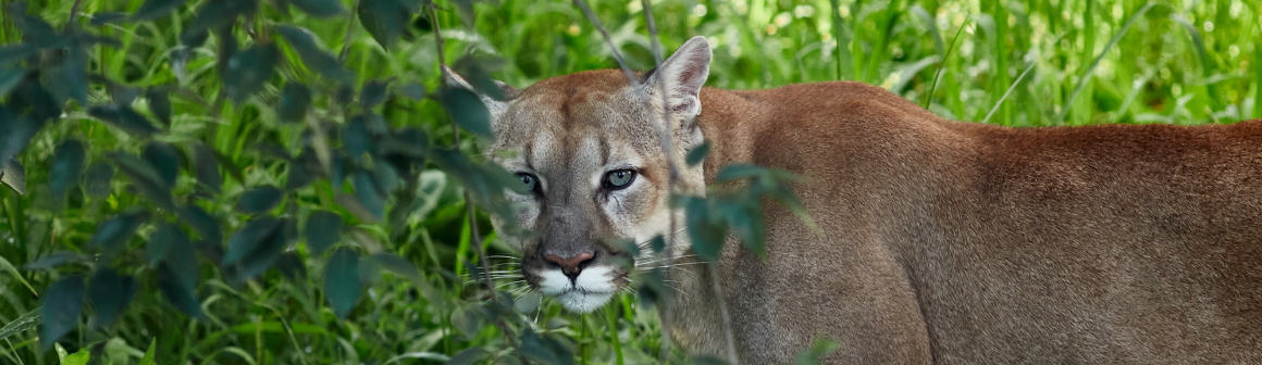
Magnificent scenery and a unique plant and animal world can be discovered here, whether by hiking, climbing, rafting, riding, sailing, kayaking, fishing, and countless other activities. Surrounded by the many snow-covered volcanic peaks, it is easy to imagine oneself in a fairytale landscape. The region also has plenty to offer in terms of its cuisine, which makes use of the best the sea has to offer: salmon, crabs, mussels, king crabs, oysters, and much more.
The climate is also very familiar to any Central European tourist: mild and with plenty of rain. It gets cooler and rainier, the further south one travels. The average temperature in Puerto Montt is 11ºC / 52ºF. During summer, daytime temperatures can reach 25º/77ºF; during winter, night-time temperatures can sink to 5ºC / 41ºF. Precipitation levels lie at around 1900mm per annum although, happily, it rains a lot less during summer. The result of the abundant rain is a fertile green landscape and, most especially, the beautiful dense ‘Valdivian’ or temperate rainforests.
Highlights
The city of Temuco is the regional capital of Araucaría. It is a region that was successfully defended against the Europeans by a long and embittered campaign by the Mapuche, and it continues to be at the heart of their culture to this day. Temuco was only founded as a fortress as late as 1881, when it was successfully used to finally defeat the Mapuche. During the years that followed, the first foreign settlers arrived and with them, in less than 20 years, the railway, banks, hotels and a telegraph cable right through the middle of Mapuche territory. There is an informative museum on the culture of the Mapuche in Temuco, as well as an interesting regional market, with colourful scenes of local fruit and vegetable selling, as well as of all kinds of Indian herbs and spices, craftwork, and jewellery.
The picturesque small town of Villarrica enjoys an idyllic location on the western shores of the lake by the same name. The most attractive neighbourhood is by the lake, where a long beach promenade is ideal for walks complemented by wonderful views towards the Villarrica volcano.
Pucón lies on the eastern shores of Lake Villarrica and grew from a garrison founded in the 19th century. Here too German settlers were soon established, who developed a wood and leather industry. Today, Pucón is an important centre for tourism, which is underlined by the good selection of bars and restaurants. During the summer months, its population increases several times. With its excellent location by the volcano and on the beach of Lake Villarrica, as well as being near the Villarrica and Huerquehue national parks and with thermal pools on its doorstep, Pucón has a great deal to offer to both adventurers and those seeking relaxation, to hikers and tourists alike.
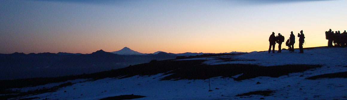
The unquestionable highlight of the Villarrica National Park is the volcano of the same name. A good level of fitness makes climbing the volcano relatively easy. At the summit, visitors can peer into the crater and there are also wonderful views towards the surrounding volcanoes. For those visitors who prefer depths to heights, a visit to the ‘Underworld’ of the Villarrica lava caves is worth an excursion: a stone witness to the various eruptions of this very active volcano. During winter, this area is also a very popular ski resort.
The amazing araucarias or monkey puzzle trees can be admired in the Huerquehue National Park; thanks to them, the region is called „Araucaría“ and the Mapuche are also known as the Araucarians. The park offers a variety of forest hiking paths past large and deeply blue glacial lakes and views onto the surrounding hills and mountains and their beautiful exotic landscape of monkey puzzle trees. An especially lovely hike is provided by the Three Lakes Route.
Valdivia is the capital of the „Los Rios“ region (region of rivers) and lies near the coast, a little way inland along the Rio Calle Calle. The city was founded there by Pedro de Valdivia in 1552 (also the founder of Santiago), due to its strategically advantageous position. However, the location was no protection against its destruction by the Mapuche in 1599. The settlement was revived years later, and installed with Dutch buccaneers and English sailors, as well as with major fortifications against the Mapuche. Here too, the cityscape was influenced by German settlers, from the mid 19th century onwards. Among other things, they established Chile’s first brewery here. Valdivia’s economy flourished during that era and the city became wealthy, which can still be seen in the many beautiful villas along the river. They make Valdivia, with its 140,000 inhabitants, one of Chile’s most attractive cities. Visitors can take a river trip along the Rio Calle Calle from the Schuster pier, or let themselves be carried away by the colourful goings on at the Mercado Fluvial, which is worth seeing. An interesting museum is today housed in the „Casa Anwandter“, once the home of the first superintendent for German settlers. The history of the region from Pre-Columbian times to the era of German colonisation comes alive there.
Frutillar is a picture book small town on the western shores of Lago Llanquihue. The lovingly restored houses with their decorative flowers from the colonial era give the visitor the impression of having travelled back in time. An interesting open-air museum exhibits restored colonial houses and furniture from the early period of German settlement. German cake specialties are offered all over town and even in the local Spanish here they are referred to as ‘Kuchen’.
On the southern shore of Llago Llanquihue lies Puerto Varas, founded by German settlers in 1854 and still very much characterised by German culture to this day. The town offers countless accommodations, from simple pensions to luxury hotels, and enjoys a good selection of restaurants. Puerto Varas is an ideal base for all excursions into the southern lakes region.
The volcanoes of Osorno, Calbuco and Puntiagudo reach for the sky beside the lake and not only provide a superb backdrop for Puerto Varas, but also offer a hiking paradise with various grades of difficulty.
Puerto Montt is also known as the „Gateway to Patagonia“. This is where the Carretera Austral begins and where the ships depart for Tierra del Fuego (Land of Fire), the Magellan Straights, and for Patagonia’s glaciers. The first German settlers landed here in 1852. The settlement was established on the orders of the then President Manuel Montt, who also encouraged Germans to settle here. One year later, the half-completed town was officially founded and named ‘Puerto Montt’, after the president. Today, the city has a population of around 160,000 and is the capital of the Los Lagos region, as well as an important transport hub. From a tourist point of view, the fishing harbour of Angelmó with its little colourful boats set before the island of Tenglo is especially interesting. The morning catch can be purchased at the Angelmó fish market or savoured directly at one of the many small cooking stalls. Right next door, there is a large souvenir and craftwork market.
The 390 sq km/ 150 sq mi of the Alerce Andino National Park encompass an area of land that could hardly be more wild or authentic. The forest is very dense, but once it opens up, it presents views of crystal clear bubbling rivers, waterfalls, and lonely silent lakes surrounded by sheer rock faces. This is where some of the last millennia-old Alerce trees stand, reaching dead straight up to the skies.
The Puyehue National Park is popular, yet not over-crowded. It was designated to protect the extensive areas of evergreen temperate rainforest that are typical for this zone. Arayan trees of unique size can be found here. Today the park encompasses 107,000 ha / 264,397 acres and spreads over altitude areas that reach from 250m / 820ft to 2236m / 7,336ft. The highest summit is the Puyehue volcano, and the Antillanca volcano is popular with skiers during winter. Thermal springs bubble from the ground here and are accessible for bathing.
The Saltos de Petrohue should not be missed on a journey to the Lake District. They are a collection of rapids and waterfalls that have washed impressive formations out of the solidified lava, and a fairytale setting is provided by the Osorno and Puntiagudo volcanoes. It is also possible to take a catamaran trip across Lago Todos Los Santos from there. The lake is surrounded by densely forested mountains, while the perfect cone of the Osorno volcano dominates the view during the entire journey. On the east side of the lake, the Vicente Perez Rosales National Park offers hiking paths and an educational nature footpath through thick cloud forest.
The Island of Chiloé is steeped in legend and lies south-east of Puerto Montt, in the Pacific. It is Chile’s second-largest island after Tierra del Fuego. The archipelago of Chiloé includes many small islets that lie off the east coast, in the Gulf of Ancud. Parts of Chiloé are protected in various national parks. Farmers and fishermen live traditional lives in picturesque villages where time seems to have stood still. The landscape is a verdant green and, whenever the sun shines, the colourful painted wooden houses and fishing boats glow in lovely colours. For a long time, Chiloé was largely cut off from the mainland so that deeply rooted traditions, myths and legends have survived to this day. The island’s emblem are its wood houses on stilts and the many wood churches that were constructed without the use of a single nail or screw and have been added to the UNESCO World Cultural Heritage List.